September 1, 2022
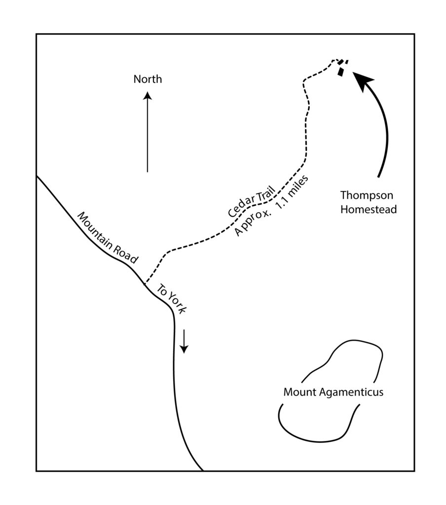
Weather wise, the first day of September could not have been more beautiful. I met Ron Nowell on Kingsbury Lane, off Route 91 in the Scotland area of York, Maine. We parked our vehicles in a designated parking space directly across from the Kingsbury House and adjacent to two concrete posts with very bold stop signs anchored atop.
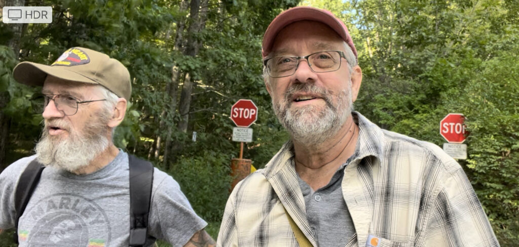
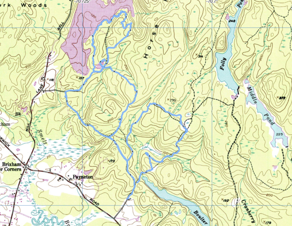
It was Ron’s intention to guide us to School House Number 7 with many points of interest along the way. The signs said cars were not permitted beyond the stop signs so we began walking up the Lane. This is the tenth walk I have taken with Ron since this past spring. We began on Third Hill, then Second Hill, First Hill, Ramsdell Marsh, and off onto the Horse Hills. We have been looking for many things but often discovering more than we planned on and sometimes coming up empty with what we intended to see. It has all been a great experience for me. Ron is unusually knowledgeable about so many things including botany that I have considered these hikes a real privilege. Yesterday we hiked much further than we intended and because of the loops it was challenging to keep our direction certain.
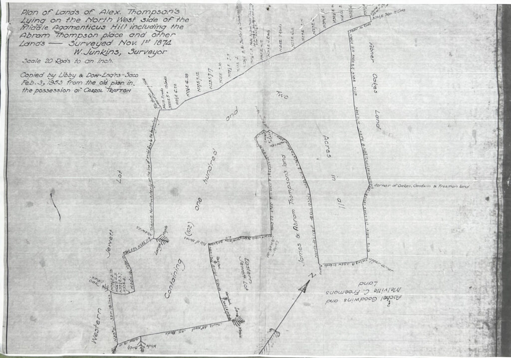
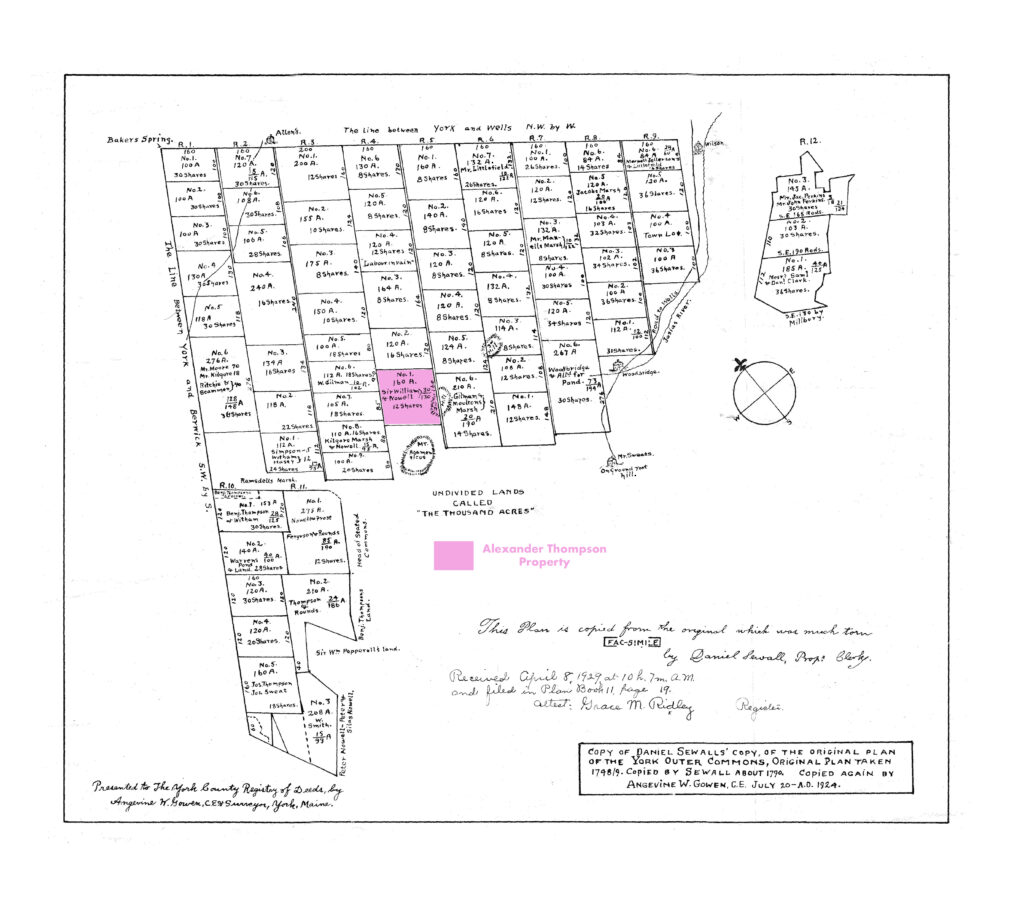
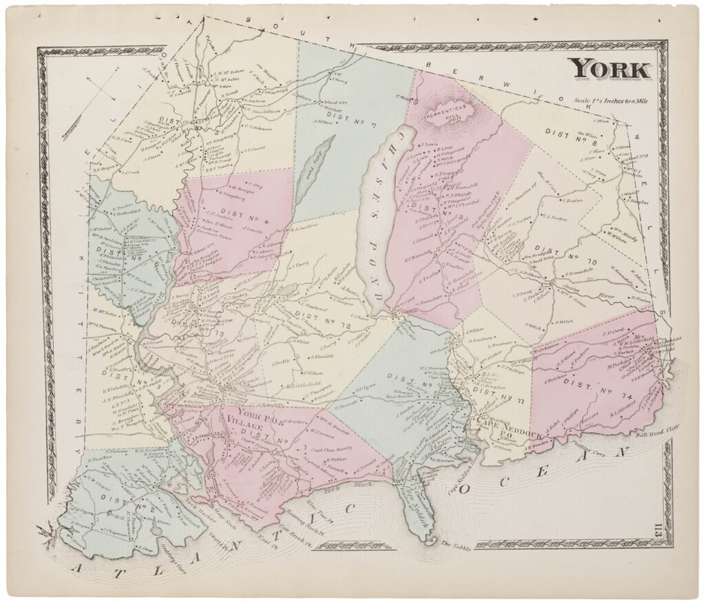
I have found the history of this area of York intriguing and consuming. Early in York’s history the town decided the Northeast area of York would be suitable for expansion and offered the mostly vacant land to the earliest and newest arrivals with the idea of development. Those here first were eligible for 8 shares, newcomers were more likely to receive less. The names for these areas were the Outer and Inner Commons, Stated Commons and ”The Thousand Acres.” From the early 18th Century these parcels were divided and sold and used by their owners for a variety of things but mostly agriculture. The designated lots were actually picked from a hat in order to avoid the possibility of favoritism. Although today there is evidence of habitation left by graveyards and cellar holes one gets the feeling living here was more challenging than the more coastal area of town.
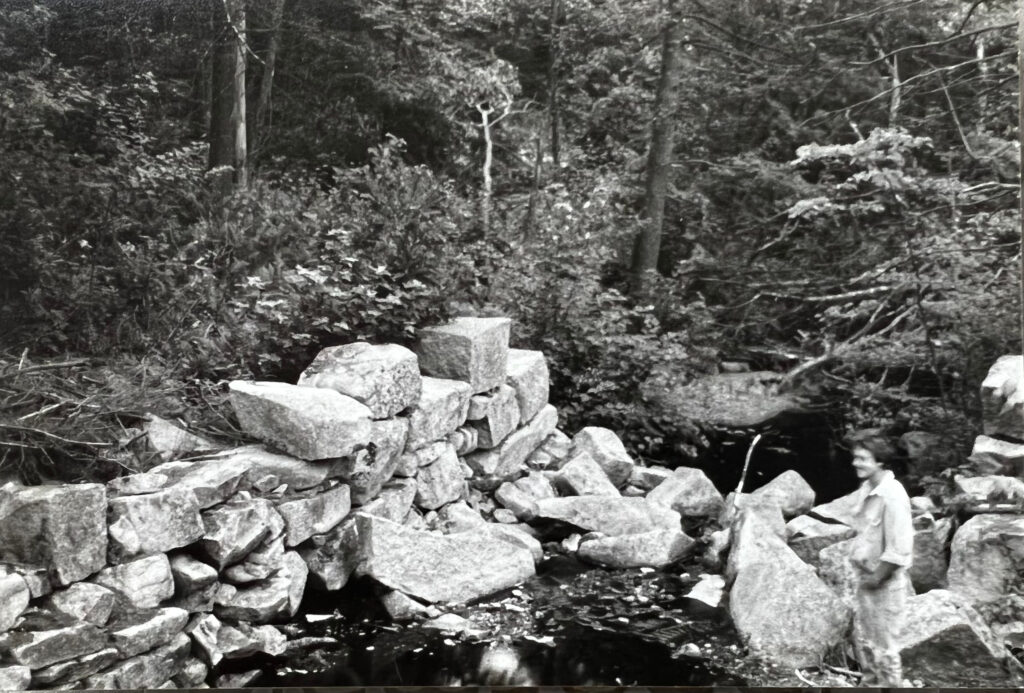
Ron and I proceeded down the ancient trails that are in some places rutted due to heavy traffic by four wheelers. We began searching for a Junkins Graveyard that we did not find but did find two cellar holes with very large stones. Both were from the Junkins family, the second built by Daniel Junkins. This cellar hole was the largest I have seen in this area and is visible and easily accessible from the trail. As we approached the cellar hole my eyes began to widen. Taking in the mammoth stones and where they were placed seemed impossible, especially as I reflected on the methods available to these early settlers of York.
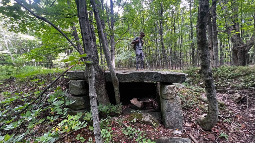
The Scottish families that came to this area from 1657 to 1671, included the Maxwells, MacIntires, Junkins and Grants among others (Banks, Volume 1, page 209). They had been captured by the English during Cromwell’s war with Scotland, taken prisoner, sent to the New World and sold as indentured servants. They eventually made their way to York where they raised large families and prospered. As evidenced by what these families left behind, they brought the craft of stone masonry from Scotland. They needed not bring stones for their craft, for there were plenty. The large stones were quarried very close to where they were placed and have rested steady for numerous generations. Some have drill marks indicating they were split with feathers and wedges, others may have been naturally squared. All were placed with great care ensuring longevity.
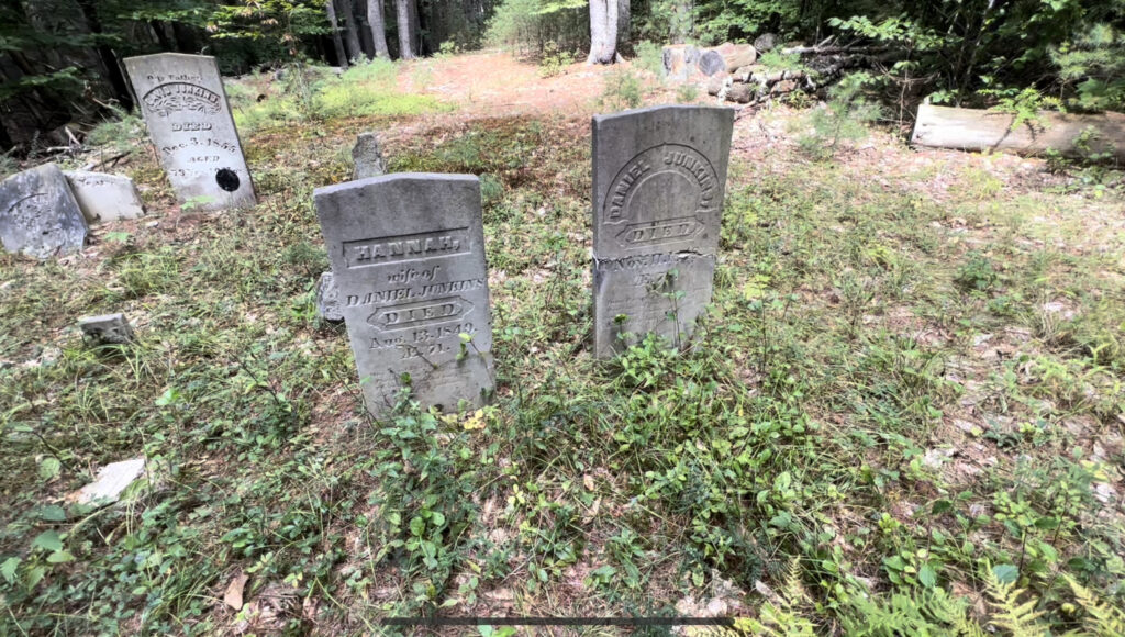
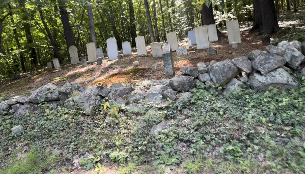
Moving on, Ron took us to a Junkins family graveyard a few hundred yards from the cellar hole. Daniel and his wife Hannah rest prominently with other family members nearby. This couple both lived to their mid seventies. Ron and I discussed how what would appear to be such a physically demanding life could lead to such a long life. We had no answer and moved onward.
At some point Kingsbury Lane turns into Linscott Road and after making a large loop we came out of the woods and walked along Linscott for about a half mile. We were looking for Old Bell Marsh Road and Ron thought we could access it by an old right of way that was created to give better access to the Stated Commons. Ron referred to this road as the back road to the Stated Commons. Although it varied in width, without measuring it was about fifty feet wide and had an ambitious stonewall on each side. In fact, on the Westerly side the wall exceed four feet in width. We walked directly up the middle to a point where Ron observed we had entered the Stated Commons.
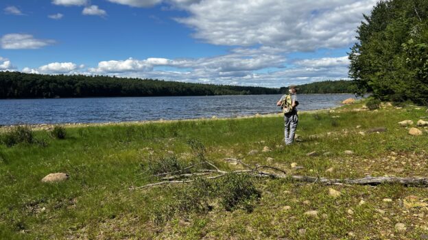
As I said previously, our objective was to find Schoolhouse number 7 but we were far away. In fact, little did we know that we also had a water feature between us and the old schoolhouse. It is named the Bell Marsh Reservoir. As we came upon it the skies opened up and there was a terrific breeze blowing cool and steady in our faces from across the water on an ideal 80°F summer day. We began to walk along the Easterly side of the spongy shore line. The beauty of the view is much enhanced by the absence of homes or other man made features, except for a dam. As we walk along, both Ron and I are constantly scanning the woods for anything unnatural, we also look for orchids and plants that may or may not belong. Sadly, the Eastern hemlock trees that are prey to the parasitic woolly adelgid. Most of the hemlock groves feel sickly making a noticeable lack of canopy. Other places are lush and green. We pass over the changing landscape, pleased by the fresh breeze or smell of sweet fern as we approach a sunny opening. We exchange observations, take mental notes, feel the Earth on the soles of our shoes that become heavier with each step and yet we are inspired by curiosity and of what might be just ahead — determined not to miss it.
Of course we cannot possibly know everything, we cannot cover all of this land, at least not today. Who knows what is hidden beyond the trails but often that is the best place to look. It is perhaps where we will find the illusive small whorled pogonia. The little orchid is an Indian cucumber root look alike in many ways. We have seen plenty of those. It feels like a miracle to be amongst so much nature in a place that people once tried to develop. Their failure has provided great benefit to future generations. Much of this land is preserved by organizations that work to keep the land natural and undeveloped. As we walk, I have never been more grateful to be the beneficiary of public access, it is invaluable.
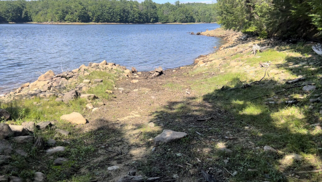
Aided with two old maps and a cell phone I often check the phone using a gps app called Gaia. I have been recording our walk and our route shows up crystal clear on the screen of the phone. I can see we are still well over a mile from Schoolhouse Number 7. I suggest to Ron that we cut away from the shoreline and begin bush whacking. I see a shard of blue plastic on the edge of the shore in the tree line and walk toward it not knowing what to expect. As I get closer it looks like a broken piece of a plastic drum. I pick it up and put it in my pack and as I do I see a trail in the woods and instinctively move toward it exclaiming the discovery to Ron. We break through the underbrush and onto the trail. As we look to our left we see the road leads right into the reservoir in the same way a boat ramp would. We realize this was the road that we have been looking for and when they flooded the reservoir they submerged this portion of the road. There are two family cemeteries that may have been submerged during the flooding of the reservoir, the Shaw family and the Nowell family. They were in the vicinity of the school house and we are hopeful they still exist above water. We can look across the water to the opposite shore and see where the old road may rise up from the depths. I look back at my phone and realize there is a large unseen bay that we would need to skirt around to get over to the point of a reemerging road.
As we walked, Ron told me that George Chapman, Jr., who passed away at 97 years in March 2022, had attended Schoolhouse Number 7. He grew up on Linscott Road and most likely walked along Old Bell Marsh Road as a means to receive his education. This really helped me to put things in perspective. This area is currently void of inhabitants but previously supported a school, tiny no doubt but in my imagination I can’t help seeing children on the trail going to and from the school. Like the small whorled pogonia, for now Schoolhouse Number 7 remains a mystery to me. Ron and I decide not to keep going forward as it nears four o’clock p.m. and we have a long hike out of the woods. My lower legs and feet feel the weight of the day. Hiking on trails, through the pathless woods and along the rocky edges of Bell Marsh Reservoir have tired me out. Ron says he can’t wait to get back to his truck, sit, read his paper and drink some coffee. We turn around leaving the schoolhouse for another day. We attempt to return the same way we came but it proves illogical.
As we are hoping to come out of the woods on Linscott Road, I am reminded of a photo that was taken of me standing at the Garey Dam. I believe Rick Foster took the photo when we were working on a stone foundation and fireplace for a new home on Geary Lane off Bell Marsh Road.
Today, these mill stones are mostly gone. And when one looks down beyond the mill the vista opens up into a dramatic view of Bell Marsh Reservoir. Ron told me that the original mill was built by the Nowell family and the Garey family later purchased it.
We finally arrive on Linscott Road and Ron points out a Junkins graveyard. Beyond that are two large cellar holes on the Westerly side of the road. They are made with large cut stones though time has rearranged them into a lazy composition of disrepair. The road has many new homes, attractive to the modern eye and well cared for. The contrast between the old cellar holes and new homes is somewhat irreconcilable. We continue walking through this old town lane lined on both sides by still sturdy stone walls. We notice some plants in the ditches and take a moment to identify them. I pick up a few recently fallen hickory nuts and Ron recalls his grandmother preparing them as a topping for oatmeal. He cuts one open. The shell seems impossible but eventually he cuts his way to the meat. He tells me his grandmother cured them by putting them on newspapers on the attic floor and suggests I do the same. Once they dry the shells will fall away, he says. I put some in my pocket for later.
We make it back to the parking lot on Kingsbury Lane which has new painting as you can see if you click here. Though draining it has been a beautiful day for a walk in the woods, my favorite thing to do. After each walk with Ron, I return home with a completely new perspective on the Mount Agamenticus area. Always inspired to find out more, I extend the trips by combing through the old maps and plans for the Outer and Stated Commons, seeing who lived where we had travelled, looking for more hints to interpret the past.